Hiking Lantau south to north
The hike: Mui Wo to Tai Ho Wan and Tung Chung.
Distance: 10 km Time: Approx 2.5 hours
A comfortable stroll into the past and future of Lantau.
This walk crosses from Mui Wo on Lantau’s south coast to Pak Mong and Tai Ho Wan on the north. A well-trodden path between villages that have historically been very close, it finishes in the shadow of the Lantau Link and the freeway to Tuen Mun, still under construction.
It’s not a demanding walk, with only a short period of uphill walking, and conveniently finishes in Tung Chung.
The journey
Exit Mui Wo Pier and head right on the footpath past the bike racks and the drab cooked food market beside one of Hong Kong’s most beautiful bays.
Track ahead on the newly-completed, tree-free walkway and turn right at the Five-Cent Bridge. You will soon reach Silvermine Bay Hotel. In the post-war era and up until the 80s this was the site of Chung Hau St, the bustling hub of daily Mui Wo life in what was then a settlement of 20,000. Because of the decline in agriculture and fishing and the emergence of Tung Chung, Mui Wo has hollowed out, with a population today of around 5,000.
Passing the hotel, follow the path around to the left and then take the right at the public toilet at the junction (remember these paths carry a regular stream of bicycle traffic; be sure to walk in single file).

Mui Wo was and still is a series of discrete villages. You are now leaving the old village of Chung Hau with a stream on your right-hand side and the village Wang Tong ahead of you. After a couple of minutes you will come to a junction. Take the left-hand fork toward Pak Ngan Heung and Silvermine Cave.
You are passing through Mui Wo’s rear garden, with a number of pretty gardens and small farm lots. It’s also occasionally wet and marshy, so you may meet the odd buffalo and egret.
After another 10 minutes you will meet the Olympic Trail. It has little to do with the Olympics, other than being built to celebrate the Beijing Games, and it encompasses the path from here to Tai Ho Wan (sometimes the entire route from Mui Wo to Pak Mong is dubbed the Olympic Trail). You’ll need to take a sharp right.
But before you do, take stock of the local attractions. On your right is the fine Yick Yuen mansion, once the home of a wealthy rice merchant. You can’t enter but even from the outside the 7.2ha estate is impressive.

Straight ahead is the village of Pak Ngan Heung. Stepping through the arch you will find a Man Mo Temple. Yes, of the same family as the famous Sheung Wan temple, offering worship to the gods of literature (man) and the military (mo). It is notable for having been in existence since Ming times. This is not quite the original object, having been rebuilt in 1901 and 1960 and refurbished in 2001, but impressive nonetheless for its 400-year history.
Head back to the Olympic trail and you will shortly encounter the popular Silvermine Waterfall. It’s a picturesque spot and spectacular in the rainy season.
Next is a short steep climb to the Silvermine Cave. It’s less a cave than the sealed entrance to the old silver mine. Not much to see here. Despite its legacy in local place names, it appears to have only lasted a decade or so. It’s not even clear when that was. The AFCD sign here says it opened in 1910, but a local researcher has put that date at 1886 . There is no dispute, however, that colourful entrepreneur Ho Amei was the founder.
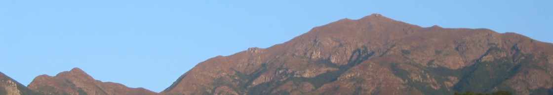
Now comes the climbing section of the walk. The reward for the effort is that the hike up the steps reveals fine views of Silvermine Bay and, on a clear day, across to Hei Ling Chau and Hong Kong Island.
After about 30 minutes from the cave you will reach the crest. Much to the amusement of other hikers, the summit market has been labelled D7 689 – uncomplimentary nicknames for Hong Kong’s current leader and leader-to-be.
From here it’s downhill all the way to Pak Mong, mostly on well-made steps.
If you’re up for a more challenging walk, you will reach the turn-off for Lo Fu Tau about ten minutes down the path. That’s a 3.4 km loop with fine mountaintop views that gets close to Discovery Bay and takes a bit over an hour.
The next rest stop as you descend is a small green-roofed pavilion offering views of Tai Ho Wan and the freeway flyover emerging out of Tung Chung Bay.
Not far past that you will reach Ngau Kwo Long. Residents here and in the neighbouring villages are in a long-running battle with government planners and ‘fake environmentalists’ and on occasion have closed the path in protest. They’ve hung banners in English and Chinese to explain why.

Shortly past Ngau Long Wan the path swings left and turns into a vehicle access road. You get a good view of the village from the road, set between the green rice fields and the mountains.
If it’s a weekend or public holiday you will meet a lot of foot and bike traffic coming from the other direction – mostly Tung Chung people.
Not far along the road brings is Pak Mong. The first thing you notice is the freeway flyover is just a few hundred metres away, towering over the village fields.

The village boasts an impressive-looking guard tower, but which was only built in 1939. The ‘sword stone’ next to it is of interest perhaps only to wonder why it should be of interest.
Finally, we reach Tai Ho Wan, the mouth of the Tai Ho Stream river which exits here into Tung Chung Bay. Hard as it is to believe, this inlet in the shadow of a flyover is a Site of Special Scientific Interest (SSSI). Greenpower describes Tai Ho Stream as Hong Kong’s “best” freshwater stream “accounting for about 29% of all Hong Kong’s freshwater fish, and the highest diversity of freshwater fish” in the city.
This SSSI, incidentally, is one of those issues that antagonise the local villagers. They will be comforted to know that its future is in doubt. Tung Chung Bay is earmarked for serious reclamation with the aim of building another 120,000 homes over the next decade or so. Environmentalists have pointed out that the reclamation runs to with 100m of the Tai Ho Wan outfall, limiting the ability of the fresh river water to circulate.

Of lesser importance: Tai Ho Wan marks the end of the Olympic Trail. Remain on the path as it skirts the little freshwater bay and take the underpass to the other side of the freeway. Take a walk to the edge of Pak Mong pier and watch Hong Kong’s newest piece of road infrastructure taking shape.
You can also savour the mere existence of the bay itself. At the other side 130ha has been swallowed up by the Hong Kong-Zhuhai-Macau bridge landing zone. If the government has its way, dredging for the housing development will start on this side later this year.
From this point take the bayside path that heads west directly to Tung Chung. Get onto Ying Hei Road and then turn left onto Man Tung Road at the intersection. It’s about one kilometre to the Citigate entrance on the left. You can find the MTR at the far end of the mall.
Getting there
Starting from Mui Wo
Take the Mui Wo ferry from pier 6 at the Outlying Islands terminal. Note the fast ferry takes approximately 30 minutes; the slow ferry 50 minutes.
Starting from Tung Chung
Take the MTR Tung Chung Line to Tung Chung. Take escalator to the Citigate Mall 2F and walk to Novotel end of the mall. Exit onto Man Tung Rd and turn right.
